• slidebg1
    WELCOME TO MYACORN
    Delivering bespoke web-based solutions
    to help you collect, visualise, analyse
    and share your data.
  • slidebg1
    DATA COLLECTION TOOLS
    Custom-built web forms
    linked to secure online databases.
  • slidebg1
    DATA ANALYSIS TOOLS
    Data analysis.
    Spatial analysis and mapping.
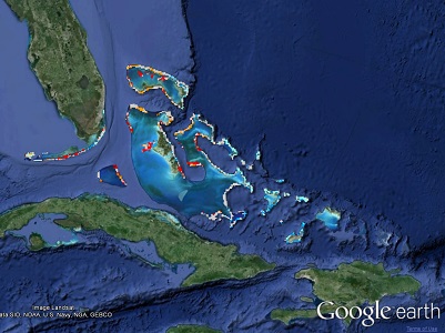
  • slidebg1
    GEOSPATIAL APPLICATIONS
    Online mapping applications.
    View, analyse or download spatial data.

Web Development

Design and development of database-driven websites with rich functionality.

Scientific Research Tools

Tools for collecting, displaying and analysing scientific data.

Mapping

Spatial data analysis and presentation, interactive geospatial applications.

Welcome to myAcorn

We provide high quality, state of the art, web and geospatial applications using the latest technologies.

Cutting-Edge Technology

We use the latest tools and software engineering techniques to provide you with a dependable and professional product. We are always operating at the forefront of technology to ensure that we can deliver the solutions you need.

Custom-Built Solutions

We design and develop tools to fit your requirements, whether this means building on existing software or starting from scratch with an entirely new application. We develop solutions across platforms, including Windows and Linux operating systems as required, and take our client's and their customer's skills into account.

We recognise that you may want to expand and extend the tools that we create for you and we are always on hand to advise on the best way to do this.

Quality Service & Support

Customer service is very important to us and we try to respond to all emails from our clients within a couple of hours.

We deal with all the administration relating to your project, whether it be organising hosting, installing security certificates. backing up servers or assisting with domain name registration.

Meet Our Team

Dr Helen J. Edwards

Managing Director

Helen is the co-founder and Managing Director of myAcorn. Helen works directly with clients to determine their individual requirements and to design custom-built solutions from start to finish. Helen has extensive experience of working with people from different disciplines and enjoys developing new working relationships.

Helen is responsible for project management at myAcorn and undertakes the majority of application and website development. Helen is continually enhancing her technical skills to keep up-to-date with the latest emerging technologies.

  • Project planning
  • Project management
  • Scheduling and delivery
  • Production of documentation and user guides

Helen's Background

Helen has a strong numerical and computing background with degrees in mathematics and biology and fifteen years experience as a computer programmer. Throughout her academic and business career Helen has developed bespoke tools for acquiring, modelling and analysing scientific data, with a particular emphasis on applications in ecology and medicine.

Web Applications

Bootstrap, Django, Django CMS, Drupal, Ext JS, WordPress.

Geospatial Applications

Google Earth, Google Maps, MapServer, OpenLayers, QGIS.

Computer Languages

C, C++, CSS, HTML, JavaScript, KML, LaTeX, Matlab, PHP, Python, VBA.

Additional Skills & Interests

Company Finance, Ecology, Mathematical Modelling, Natural History, Peer-reviewed Publications, Simulation Modelling.

University of York, York, UK

2006 PhD, Department of Biology

Thesis: Individual-based models of the movement of Atlantic cod.

Supervisors: Dr Calvin Dytham, Dr Jon Pitchford, Dr David Righton (Centre for Environment, Fisheries and Aquaculture Science).

2002 Master of Research in Mathematics in the Living Environment
(Pass with Distinction)

Dissertation: Predator-prey models: investigation of two and three species complexes with application to the North Sea sandeel-cod-man interaction. Location: Centre for Environment, Fisheries and Aquaculture Science (CEFAS), Lowestoft, UK. Supervisors: Dr Carl O'Brian, Dr Ewen Bell.

2001 Bachelor of Science in Mathematics (2:1)

Modules included: analysis, calculus, differential equations, finance, matrices, mechanics and statistics.

University of Exeter, Devon, UK

2005 - 2008, Post Doctoral Researcher
Marine Spatial Ecology Laboratory

Helen's post-doctoral research, conducted at the Marine Spatial Ecology Laboratory, consisted of various projects related to coral reef ecology. Helen was funded by the US Environmental Protection Agency on a grant titled `Connectivity in marine seascapes: predicting ecological and socioeconomic costs of climate change on coral reef ecosystems'. This involved using global climate model projections of sea surface temperature and historical hurricane datasets to map disturbance regimes across the Caribbean and the extension of an existing model of coral-algal-grazer interactions to explore the potential effects of climate change on coral reef ecosystems.

In collaboration with other members of the Marine Spatial Ecology Laboratory Helen developed tools for conservation planning with the aim of integrating biodiversity and socio-economic perspectives into reserve-system design and of selecting networks of reserves capable of meeting conservation objectives under different climate change scenarios. Helen has also worked on matrix projection models of coral and algal populations and on the development and analysis of differential equation models of species interactions.


Mr Ian Edwards

Technical Director

Ian is the co-founder and a director of myAcorn Limited. Ian is primarily responsible for server administration, web databases and making sure everything runs smoothly behind the scenes.

In addition to providing stable development platforms, Ian advises on the latest technologies to deploy in projects and the most appropriate software-engineering methods to utilise.

Ian's background spans academia, government and industry, where he has designed, built and deployed major applications. Ian is also responsible for our cloud-computing strategy that ensures that we successfully deliver large and complex web applications that can scale with user demand.

  • Technical consulting
  • Researching emerging technologies
  • Advanced support
  • Server configuration and administration

Server Administration

Apache, Bash, Linux, Windows.

Databases

MySQL, PostgreSQL, SpatiaLite, SQLite.

Computer Languages

C, C++, CSS, HTML, JavaScript, KML, Matlab, Pascal/Delphi, Perl, PHP, Python, R, Visual Basic, XML.

Geospatial Applications

GDAL, GeoServer, GeoNetwork, GeoNode, Google Earth, Google Maps, GRASS, Leaflet, MapServer, OpenLayers, PostGIS, QGIS, TileMill, ZOO-Project.

Web Services

AJAX, REST, WCS, WFS, WMS, WMTS.

Software Engineering

Eclipse, Git, Github, Pivotal Tracker, Stash, SVN, Travis CI.

University of York, York, UK

2002 Master of Research in Mathematics in the Living Environment

Dissertation: Transient effects of grazing and seasonal controllers of primary production in the Southern Ocean. Location: British Antarctic Survey (BAS), Cambridge, UK. Supervisor: Prof. Eugene Murphy.

2001 Bachelor of Engineering in Computer Science
(1st Class Honours)

Dissertation: A simulation of probabilistic mobile robot localisation.

Met Office, Devon, UK

2012 - 2015, Technical Lead (previously Senior Software Engineer)

As Technical Lead for geospatial applications, Ian developed solutions using geospatial software libraries including the Met Office's own open-source software and was instrumental in getting the Met Office Iris software included on OSGeo Live.

During his time at the Met Office, Ian held external positions including being the chair of OSGeo UK and working alongside the Open Geospatial Consortium (OGC). He was a member of the organising committee, and a workshop presenter, at the Free and Open Source Software for Geospatial (FOSS4G) international conference in Nottingham, UK in 2013.

University of Exeter, Devon, UK

2006 - 2010, Research Associate
Marine Spatial Ecology Laboratory

Ian's post-graduate research, conducted at the Marine Spatial Ecology Laboratory, consisted of various projects related to mapping of marine habitats and the design of marine reserves. Ian was funded by the Khaled Bin Sultan Living Oceans Foundation on a grants titled `Patterns of Biodiversity and Climate Change Impacts in the Bahamas: Data to Support the Planning of Marine Reserves'. This involved the creation of a national-scale marine habitat map from Landsat satellite imagery and the use of this map to explore Bahamas-wide mangrove-reef connectivity, to rank the importance of different habitats, to determine the hot spots of beta diversity and the impacts of hurricanes and coral bleaching resulting from global warming.

Ian also conducted research into the patterns of biodiversity and climate change impacts in the Caribbean and generated data to support the design of marine reserves.

University of Cambridge, UK

2003 - 2006, Research Assistant
Centre for Housing and Planning Research

In the Department of Land Economy Ian worked on a number of projects related to the provision of housing in the UK, with particular reference to the provision of social housing through the structuring of social rents. These focused on the statistical analysis of large data sets and the incorporation of results into policy documents.

Our Services

We provide high quality, state of the art, web and geospatial applications using the latest technologies.
We specialise in helping our clients to collect, analyse and present their data.

Web Design & Development

From simple website design to advanced web-tools we provide you with custom solutions.

  • Web Design
  • Custom Web-Based Tools
  • Content Management Systems
  • Secure Websites (SSL)
  • Server Administration

Data Collection & Analysis Tools

We develop easy-to-use tools for collecting and analysing scientific data.

  • Fully Customisable Web Forms
  • User Management
  • Email Notifications
  • Secure Online Databases
  • Data Analysis Tools

Geospatial Applications

We help you to create the tools you need to collect, visualise and share your geospatial data.

  • Spatial Analysis
  • Map Styling and Symbology
  • Custom Mapping Tools
  • Interactive Web Maps and Apps
  • Geospatial Consulting

SELECTED PROJECTS

Summaries of some of our recent collaborations

Our Clients

Contact Us

Please contact us to discuss your requirements.